Winning the lottery
In EVERY DAY IS A FIELD TRIP chapter 36, I talk about bucket lists. One of mine is hiking the highpoint of each of the 48 contiguous United States. If you want to hike Mt. Whitney, the highest contiguous US peak, you must first overcome a barrier most peaks do not possess.
You must first secure a permit. Every year from February 1st to March 15th, you can submit to the permit lottery at www.recreation.gov. It takes place some time around March 24th. You will be notified if you are one of the lucky winners of the lottery.
My friends Mark, Matt and I had submitted requests for three years running without success. This year we upped our chances. My brother Scott, son-in-law Bryan and hiking partner Nicole also submitted for the prize.
Announcement Day
There are one hundred day use permits issued for each day, and since it is only four hours from Los Angeles, and it is the highest peak in the contiguous United States, there are a lot of applicants.
On lottery announcement day, Scott was the first with results. He announced he did not get the permit. Nicole revealed the same result. Bryan also received a negative result. I started to think we were going to miss out again.
Mark sent a text to the group that included the big news. He had won the lottery, and had secured the date of August 8th! We immediately moved into action, securing hotels and campsites.
Matt received his negative permit result, then my results came in: Also positive I had won the date of August 22nd. This would give us a backup date if weather prohibited us from hiking on August 8th. We would release the date back into the lottery if we had success on the eighth.
About a month before the hike, the group who would hike ended up being Mark, Matt, Tim, Jake and myself.
Getting to the highest peak in the contiguous US
I flew into Las Vegas August 4th, 2022. Matt drove in from Colorado and picked me up at the airport. We drove directly to Rosalia Le French Cafe at Winter Garden for lunch to go. I had an amazing smoked salmon sandwich on what I would describe as a sour dough hard roll (not day old, think New York roll). The roll was perfect, crunchy outside and chewy inside. I also ordered an almond croissant covered with chocolate and cherry dressing.
It took us about four and a half hours to get to Lone Pine, California. Mark, Tim and Jake (Tim & Jake are Mark’s adult sons). Along with Mark’s wife Kate decided to visit Death Valley for a couple of days prior to the hike.
Where to stay
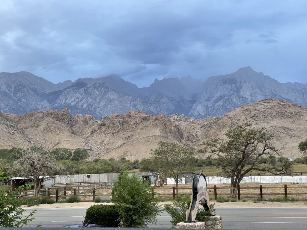
We opted for the Quality Inn at Lone Pine. Last year when we hiked Boundary Peak the highpoint of Nevada on the California border, we stayed up the road about 50 miles in Bishop. But this time we wanted to be closer to Whitney Portal. We chose the Quality Inn. and enjoyed a view of Mt. Whitney, the highest peak in the contiguous US right from our patios. We would stay at the Quality Inn for three nights prior to moving to the campground.
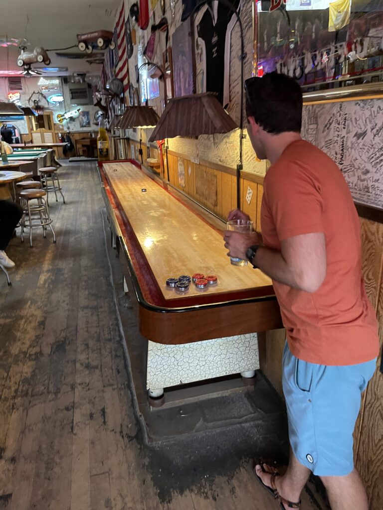
Once our bags were dropped we headed out to check out the small town of Lone Pine. We decided to eat at Bonanza Family Restaurant, a Mexican joint. With our window table we noticed Jake’s Saloon across the street. It had a swing door (Half door like the old westerns), with this door and the old wood look, we had to head over after dinner.
I fashioned my walk through the swing door after John Wayne. I sauntered through the door, stopped once inside and took a look around. There were only a few people in the joint at the time, and nobody challenged me to a gun duel on Main Street. With that, Matt and I spied a bar shuffle board table and spent the entire time at Jake’s playing the game. A regular billiards crowd came in for a tournament and the place started to fill up.
Stretching the legs
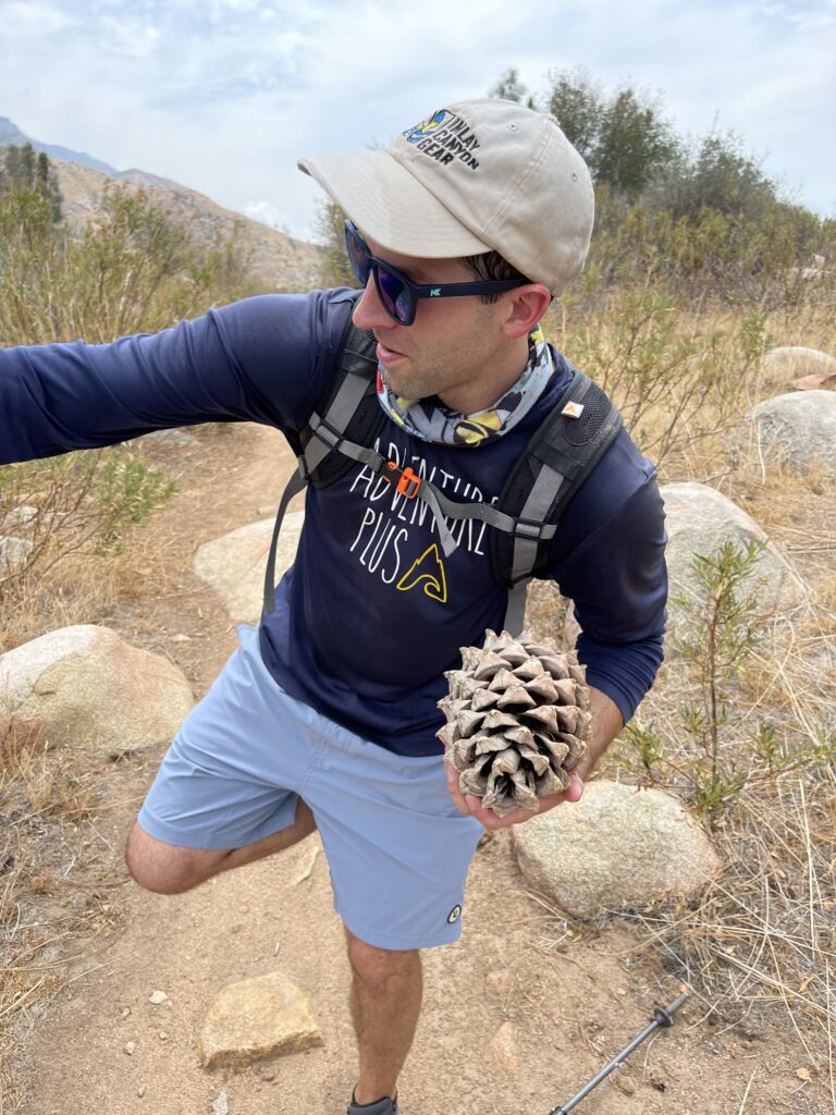
It was raining in Lone Pine, Bishop, and Death Valley Friday. so we called an audible, and saw the weather a couple hours south was hot and sunny. We took a great drive through what seemed to be several different eco systems. The highlight was the section with Joshua Trees. We ended up in Kernville for lunch. A lovely town near Lake Isabella. We stopped at the town center, equipped with a town common/green and several shops. This was a great time for lunch at Big Blue Bear Cafe, the food was good and we moved on to Whiskey Flats Trail for our hike.
The trail was in a rolling desert. and it was hot in the upper 90’s. It did feature the Kern River, and the largest Pine Cones I have ever seen.
Following the hike, we headed up to Bishop as Matt needed a tent and sleeping bag. This is where we had perhaps the coolest retail experience ever at Mammoth Mountaineering. The clerk Rachel, lent Matt her tent and bag for our camping at Mt. Whitney (we did also buy other items).
We found the Bishop Street Fair taking place and decided that would be a great place to eat. I had the New Zealand Pies at the food truck Pino Pies. I had the sweet potato pie which were fantastic.
Acclimation for the highest peak in the contiguous US
Before hiking up to 14,505 feet, it is important for someone who basically lives at sea level to acclimate to the altitude. Lone Pine is at 3,727 feet. So it really didn’t provide acclimation support.
We chose to hike Cottonwood Trail on August 6th. The drive to the trailhead was a worthy trip in itself. Climbing the mountain road that is Horseshoe Meadows Road.
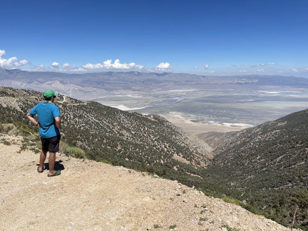
Cottonwoods trail was beautiful. I felt like I was at the Ponderosa (from the Show Bonanza), The trail goes up to 12,000 feet with not a lot of elevation gain. So it was the perfect acclimation hike. We hiked about 14 miles so we did not tax our legs. The crown jewel of this area were the Cottonwood Lakes.
Mark, Kate, Tim, Jake and I spent Sunday August 7th at Manzanar National Historic site taking in the history of the cruel fate of Japanese Americans in 1940’s America.
Campsite
We decided we would leave for the campsite at 5:00 PM. We grabbed a sandwich for the campsite dinner at Jersey Mikes in Lone Pine.
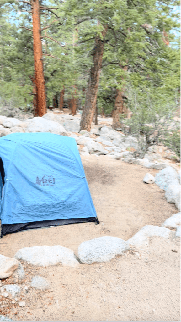
The Family Campground at Whitney Portal was beautiful. Nestled between two glaring mountains, with a river running through it. Each campsite had big boulders and lots of space.
The campsite where I would pitch my tent was perfect, with the gentle sounds of the river, it was peaceful. It took me only a few minutes to set up my REI Tent (I practiced at home before the trip). Although it is a two person tent, I think it is perfect for one person. With lots of room.
I laid my sleeping pad in the center. On the left I had my phone charging with a portable charger, bear spray in case Yogi mistaken thought I was his dinner, a portable light (so as not to use the headlamp I would need for the hike). On the right was a water bottle, and my shorts, and shirts for hiking. I followed all the bear safety rules, putting all food in the bear locker. Nothing in the tent and nothing in the car that the bear could be interested in. I brought my sandwich up to Mark, Tim and Jakes site, and we had a nice dinner in this amazing spot.
We turned in for the night at 8:40 PM and set alarms for 12:30 AM. I was so comfy in my tent, the weather was perfect about 55 degrees, the elevation at the campsite is around 8,000 feet, so no problem with altitude. The only problem was my mind. It was racing and I could not slow it down.
On top of my mind was the excitement of hiking to the highest peak, I mean I was excited. Thinking about bears a little, but mostly the hike.
I slept for a total of zero seconds. Finally I gave up at 11:45 PM, and started getting ready. Rolling up the sleeping bag, changing into the hiking clothes, putting on my trail runners. I made a couple trips to Matt’s car, putting the items from inside the tent on top of his car (He had the keys). Returned and quickly took down the tent.
Bear, Oh My!
Reaching over toward the rock where the tent bags were, my headlamp spotted two big red eyes looking right at me from about ten feet away. This Bear just stood there looking at me, like he was thinking “what are you doing out of your tent?, this is my time”.
There had already been so many potential no goes for this hike, waiting for years to get the permit, covid, pulling a hamstring two weeks prior to the hike on a training run, the portal road closing two days before the hike because of mud slides after a big storm, eating bad food the day before the hike, no sleep and now facing off with a bear. Could the highest peak in the contiguous US be off limits to me?
I had my bear spray ready with the safety guard off and ready to launch if needed.
He did not seem too interested in me. As I watched him turn toward the bear locker, and then go on two legs to check out what I had put on Matts car, I realized he probably took this same route multiple nights each week. Checking to see if anyone did not close the bear lockers properly, or if they left food in the car or campsite. Once he moved over near the locker, I walked up to Mark’s tent site (they had just risen, and showed them the bear with my headlamp flashed on him.
Once the bear moved over near the river, I took this photo.
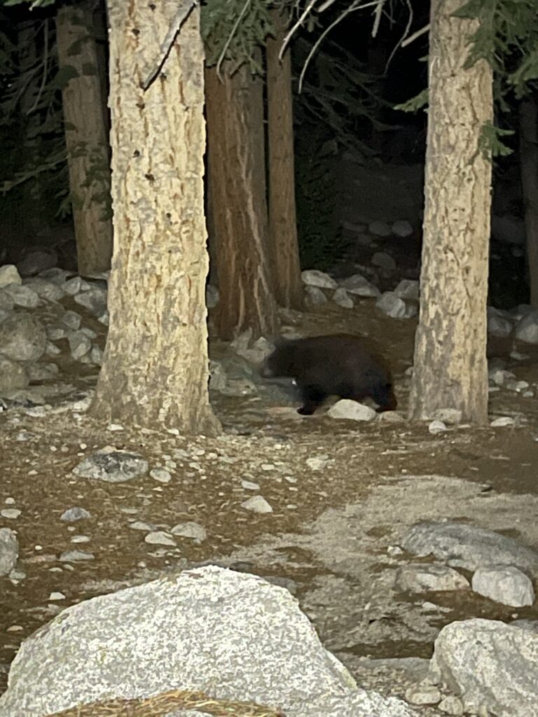
Not sleeping paid off, I had the opportunity to see this bear up close.
Time to go up
We packed our cars and drove the short distance to the trailhead for our planned 1:00 AM start. With headlamps on we started our ascent of the highest peak in the Contiguous United States.
Hiking with headlamps in the dark is a very cool thing. It changes all things sensory that you may feel during a daytime hike.
Sound
I hear everything when hiking with headlamps, even though there were five of us walking on Whitney trail. The birds were chirping, the rivers flowing, the scurry of animals near the trailhead and early on, the sound of the occasional car on the camp ground road that would become far below us and out of site and sound fairly quickly.
Smell
On the early stages of the hike, the smell of pines was present at the lower elevations of 8,000-9,000 feet, the smell of flowing water in the rivers, the mist coming off the many waterfalls are at center stage when your sight is limited.
Sight
While the headlamps give you sight on the trail, enough so you do not trip or fall. What they do not give you is long view. While we heard the waterfalls and the rivers, we only saw the few that we crossed or walked by within ten feet or so. We heard big waterfalls, and rushing waters, that we would have to wait until late in the day to see.
I love taking a few minutes along a night time hike, to look into the woods with my headlamps. This is the easiest way to spot wildlife. The red eye affect makes it impossible not to see a creature who happens to be nearby.
Touch
On this morning, we would cross big logs that laid over marshy areas. These slick supports are essential that your feet connect, and feel the way through or your feet would be wet for a long time.
As we started to climb to higher elevations, rocks would come into play, feeling the sometimes sharp granite as you try to gain balance, or the well positioned tree branch along the route are welcome mountain aids.
My hiking partners on this day are all strong hikers. Matt is in his early thirties lives in Colorado and can fly up 14,000 foot mountains. Mark has climbed all the tall peaks in New England and the Southeast, and hiked Kings Peak a 13,528 ft mountain in Utah with me last summer. He trained for this hike climbing stairs at his office building and by going up and down the Blue Hills a dozen times in a row, and hiking the Presidential Range in New Hampshire with me. Tim & Jake are both in their twenties, and in great hiking condition.
Sunrise
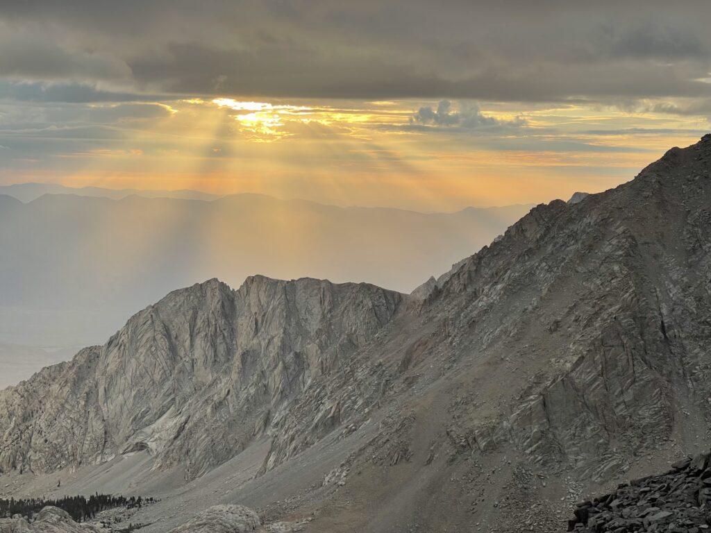
We were hopeful of a sunrise as we were on the ninety nine switchbacks which we learned faced the rising sun. Mother Nature did not let us down, the brilliant sun started to rise allowing color into the dark sky.
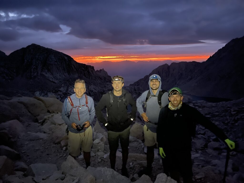
A short time passed after this glorious sunrise, when we were awed at this beautiful sight. We were near the top of the switchbacks when the sun rose above the clouds and radiated as one last wow to the sunrise.
Altitude
At high altitude, barometric pressure may be significantly lower than at sea-level. The result? Oxygen molecules are spread further apart, lowering the oxygen content of each breath. Because of the reduced availability of oxygen in the air, blood oxygen levels decrease, and the body struggles to deliver oxygen to tissues, muscles and the brain.
Your effective O2 rate at sea level is about 20%, at a moderate altitude of 6,000 feet it goes down to 16%, at a high altitude of 10,000 feet it goes down to 14% and at a very high altitude of 13,000-14,000 feet it gets into the 12% range.
For these reasons one can easily get acute mountain sickness (AMS). Symptoms include headache, nausea, shortness of breath, dizziness in other words feeling like you have a hangover.
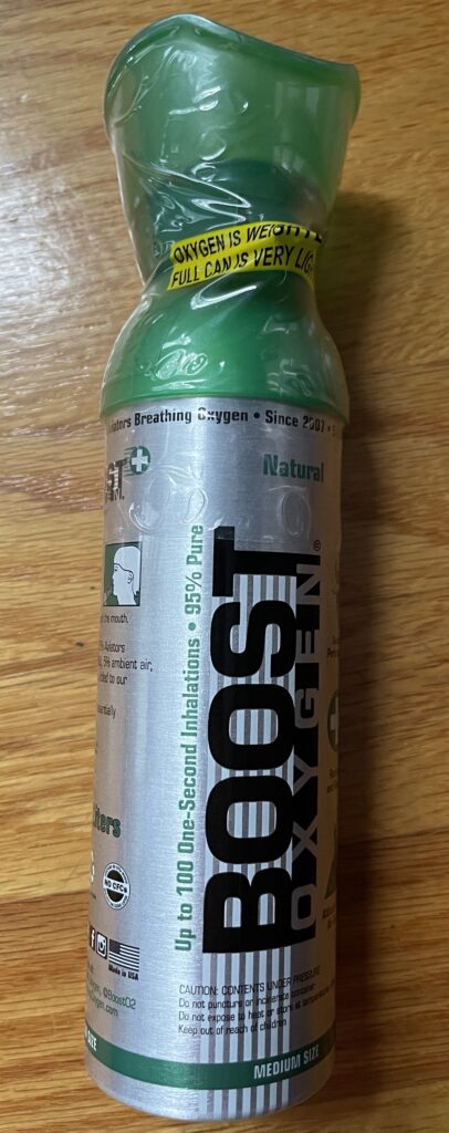
For this reason on very high altitude hikes like the highest peak in the contiguous US, I always bring a can of oxygen, the cans weigh nothing and can prove helpful if needed.
Another bonus for climbing the highest peak is it has been proven the older the hiker, the more likely he can develop AMS symptoms. It gets harder every year!
Having these symptoms are not something you can ignore, untreated and ignored AMS can lead to death.
Checking in
I always check in on my hiking partners as we spend more time over 12,000 feet. When I found out that Jake had some symptoms I encouraged him to take a hit from the can of oxygen. I took a few hits at around 13,500 feet. I am not sure if the oxygen hits actually work or if it is a placebo effect but it kept me going.
Rangers have said, “about 50% of the hikers who attempt Whitney actually summit”. Our goal was for all of us to reach the summit and when you are determined to reach your goal, you should make sure your entire group is feeling well and if need be give the oxygen a try.
Sequoia National Park
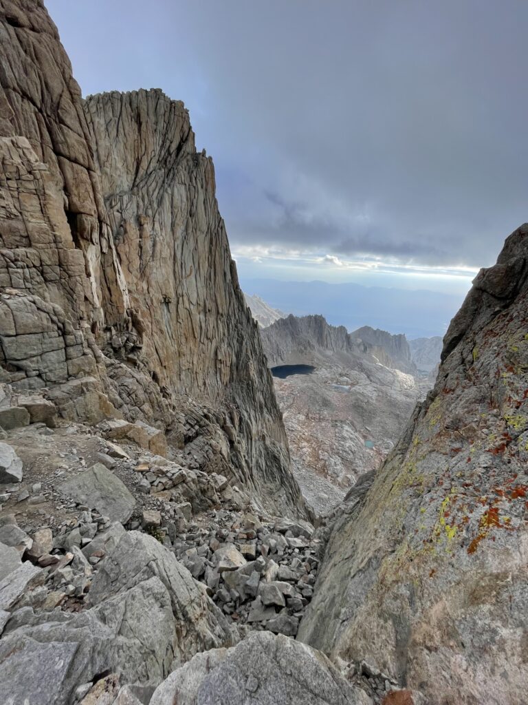
At the ridge line we crossed into Sequoia National Park from Inyo National Forest, while a long way from the giant Sequoia’s that make the park famous. Scaling the highest mountain on the eastern edge of the park is pretty cool.
At some point during most hikes you reach what is called false summits. You see something that looks like the peak, and get excited that you are almost there. With hiking trail aids like Alltrails, it is easier not to fall for the false summits. Today, we would pass a bunch of big summits that were not quite “IT”. Including Mount Muir at 14,013 feet, Aiguille du Paquoir at 14,010 feet, Aiguille Junior at 13,921 feet, the Third Needle at 14,082 feet, Crooks Peak at 14,207 feet and Keeler needle at 14,272 feet.
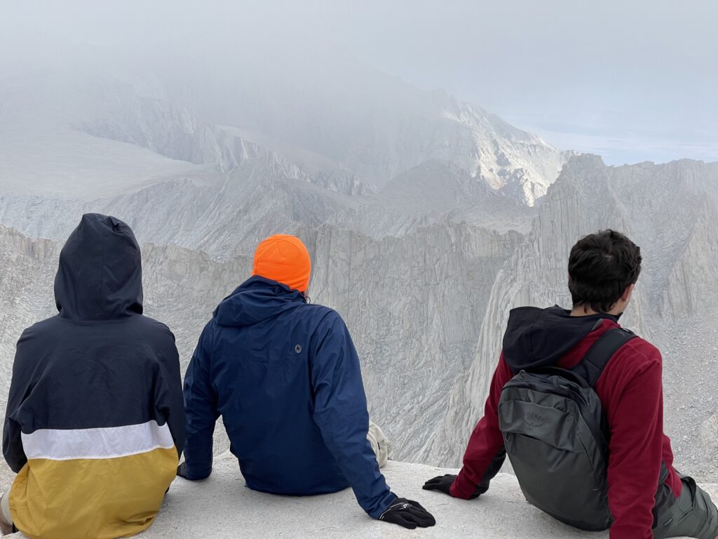
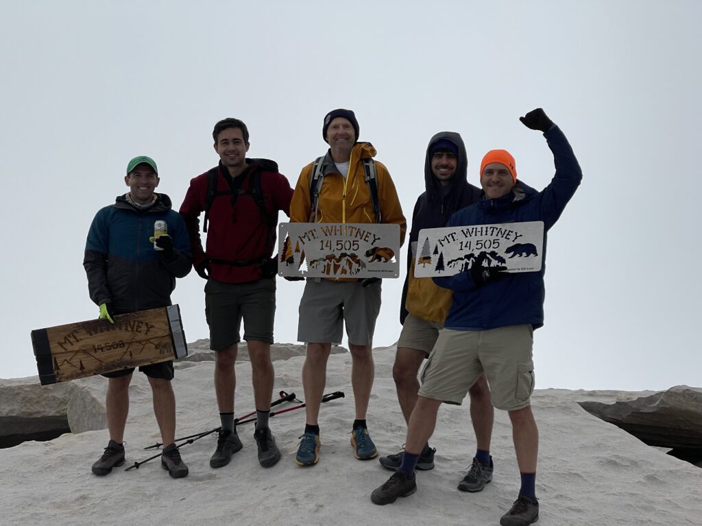
As we approached the summit, all I could think about were the pleasures of going down the mountain, and the fact that my lungs could stop burning soon! The clouds moved in as we reached the summit. It took away the long range views. We still could see some of the neighboring peaks.
Above 328,000,000 people
Standing above the entirety of the contiguous United States of America would have to be short lived. I forgot that I wanted to make a video of being higher than everyone else in the 48. It was only 8:30 AM and the storms were not supposed to come in until after noon. Due to an impending rain and lightning forecast, we opted to take our summit photos, enjoy the summit for five minutes or so and start heading down. Standing above the continent, we were grateful for the moment at hand.
Once we started the descent, I kicked it into gear, knowing we still had a lot of work ahead of us to get back to the trailhead.
The large number of switchbacks and the use of trekking poles made this descent easier on the legs and knees. They also allowed for a much faster descent.
See it again, for the first time
The beauty of this day continued once we passed the ridge line and reached the switchbacks. We would be seeing the long view for the first time in daylight, since we were wearing headlamps on the way up. It was like a whole new hike.
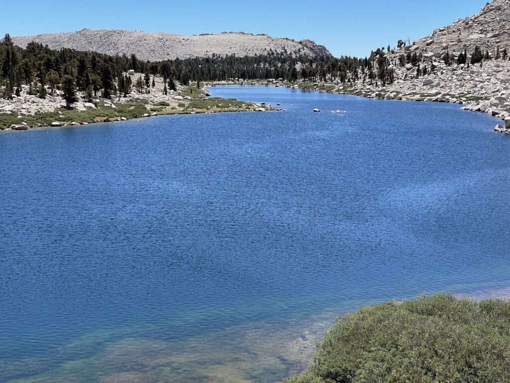
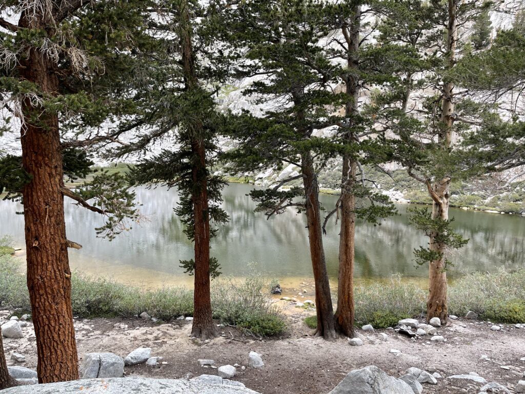
Consultation Lake was beautiful as was Mirror Lake.
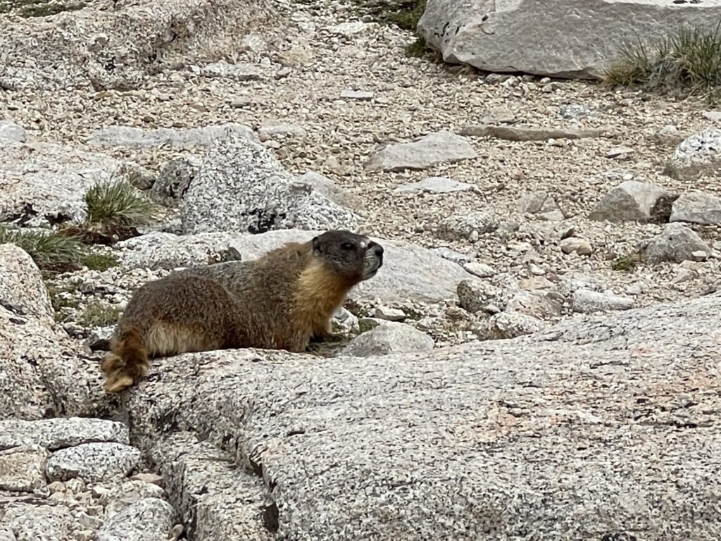
While still up among the rocks and above tree line we would see the occasional Marmot scampering across the rocks.
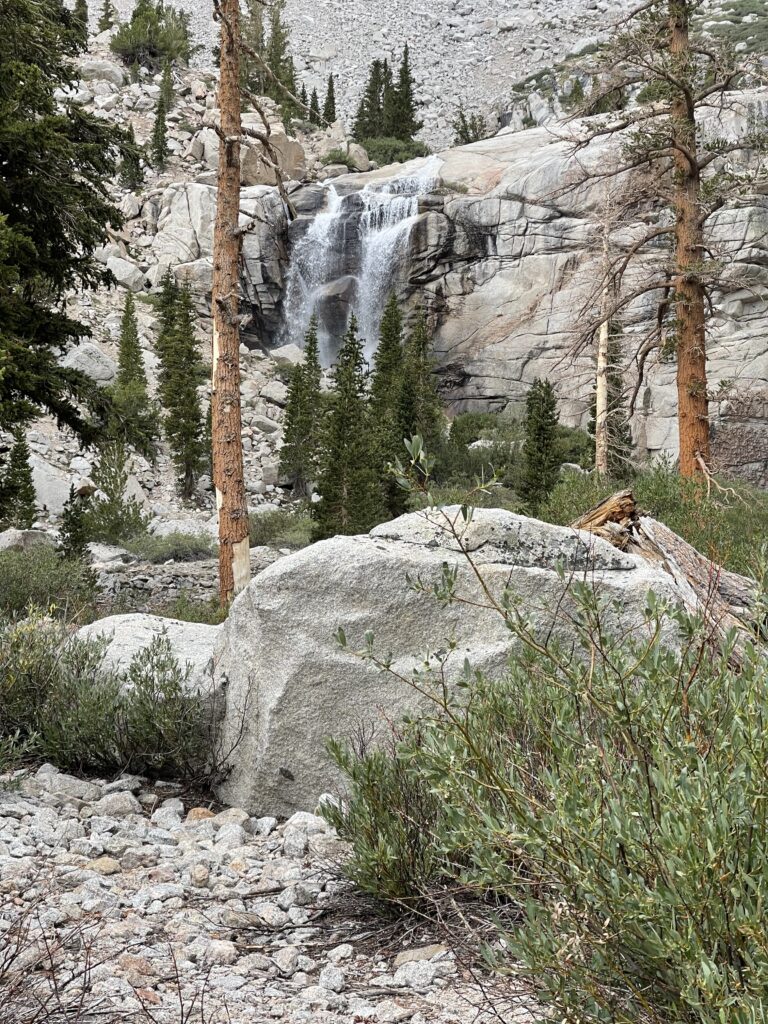
From the lakes come waterfalls, and these waterfalls were fantastic.
One of the greatest things that come from a twelve hour hike with a group of guys, is the conversation. Politics, good food, sports, family & careers all were discussed on our wonderful day in the John Muir Wilderness at Inyo National Forest and at Sequoia National Park.
As we reached the trailhead we had visions of our next meal, and I must admit, I was thinking about where I would sleep for the first time in two days.
To read more blogposts EVERY DAY IS A FIELD TRIP
To share your personal field trip stories or be inspired by others join our Facebook community